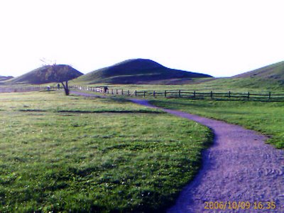
News From Old Uppsala

Back in January I blogged about exciting new discoveries at Old Uppsala. Today I visited the place and heard talks by a large number of scholars working on issues related to the site, including Magnus Alkarp and Neil Price who identified the foundations of the wooden church as reported here previously.
Here are the most interesting tidbits that I picked up today.
- Geoarchaeologist and palaeoecologist Magnus Hellquist presented bore core studies of sediments from the little vanished lake of Myrby träsk immediately west of the Royal Barrows. It seems that right about the time when the barrows and the longhouse plateaux were built, there's evidence for enormous localised soil erosion and sediment redeposition in the lake.
- Alkarp & Price are preparing an on-line gazetteer of interventions into the ground at Old Uppsala, archaeological and otherwise. The model for their project is Martin Carver's work at Sutton Hoo, only they're covering a much larger area. I've done similar work on the Barshalder cemetery on Gotland (covering, among other things, about 45 seasons of fieldwork since 1826). If we're lucky, Alkarp & Price's work may finally lead up to a large-scale excavation campaign at Old Uppsala, the first since the mid-19th century when the Royal Barrows were opened. Dig the mutha, say I!
- Lars-Inge Larsson showed some jaw-dropping geophysical survey data from the longhouse plateaux. After less than two days in the field, and without lifting a single turf, he's got the as yet unexcavated foundations of the royal halls and later buildings mapped out in great detail. I've got to get this guy to do my ploughland sites in Östergötland before I start digging there.
Labels: archaeology, Sweden


6 Comments:
What geophysical method did Lars-Inge use?
Ground Penetrating Radar, Sw. georadar.
I saw Lars-Inge´s and Immo Trinks´ presentation last autumn at the National Heritage Boards seminar on ICT and Cultural Reosurce Managment and the results from Old Uppsala are truly amazing. The documentation from the seminar (Lars-Inge´s and Immo´s method is included) is dowloadable at www.fmis.raa.se (on the "Ladda ner" page).
From what I understand they use both georadar and magnetometer and combine those two in a purpose-designed software tthat aids in analysis.
He and Immo Trinks have done similar surveys at some other places (e.g. the black soil on Björkö IIRC). I hope they will present som of those results later this winter.
I heard just over lunch a that their work at Björkö has already sent the established ideas about the town plan into the garbage can. Cool!
i really like the color of the purple gravel road against the green grass
Yeah, sometimes the crappy camera in my handheld computer does produce some cool effects. I cranked up the green on the grass to get that contrast.
Post a Comment
<< Home